

What Are Top Requirements for Map Plotters for Printing GIS Maps

In 1597 Sir Francis Bacon declared that "knowledge is power." Back then, the known world was a lot smaller, and he was only armed with a handful of books.
Today, anyone with an internet connection can get a mountain of knowledge, with a single mouse click.
This is easily showcased by the amazing amount of geographical information instantly available through Google Maps or Google Earth.
Both of these applications operate as web-based conglomerations of data sourced from both data and images, sourced from satellite imagery, aerial photography, and GIS.
But, if you need a way to actually print this data in the form of GIS maps, aerials, or images, you need a printer that is fully capable of handling the task.

What is GIS Exactly?
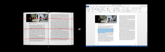
GIS stands for Geographic Information System. This is a computerized system that blends images and data from cartography, statistical analysis, and database technology.
ESRI, the global leader in GIS software, defines GIS as:
"A framework for gathering, managing, and analyzing data. Rooted in the science of geography, GIS integrates many types of data. It analyzes spatial location and organizes layers of information into visualizations using maps and 3D scenes.
With this unique capability, GIS reveals deeper insights into data, such as patterns, relationships, and situations—helping users make smarter decisions.
In layman's terms, GIS is a way to visually represent data on a map or aerial photo. Then you can filter that data to produce a type of visual report." - ESRI
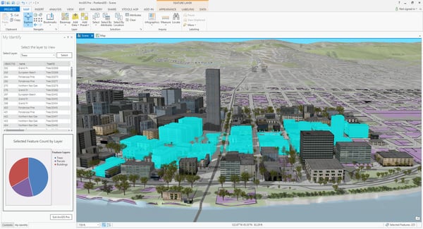 Photo credit: ESRI
Some examples of GIS are:
- Mapping high crime areas for city planners and police forces
- Displaying election results by region
- Visualizing rainfall and watershed information
Really, what makes GIS so dynamic is the fact that it can serve a wide range of industries and disciplines including:
- Spatial Analysis and Research
- Archaeology
- Geography
- Cartography
- Land Surveying
- Oil and Gas Exploration and Production
- Public Utility Management
- Urban Planning
- Landscape Architecture
- Plus many more!
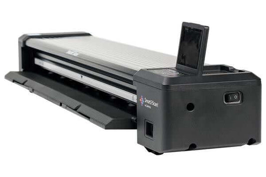
What specs are important regarding the best maps plotters for printing GIS maps?
[ See Canon map plotter options ]
Rather than focusing on a particular brand of map printer, consider some physical and technical aspects important to producing a high-quality map quickly. There are various types of plotter models available - picking the right one for your application is crucial.
Printing Width
Printing maps are often require much larger sizes than the thirty six inch format of many CAD plotters. Usually a forty two or forty four inch plotter is preferred for printing maps. In fact, many archived aerial images on a 40-inch by 40-inch format.
So, wider is definitely better when maps are concerned. Plus, big maps are just plain cool and will have a "wow factor" that will get you remembered.
Processing Power
GIS files can be HUGE. Sometimes they are in the GB range. So, you better have the processing power to chew through those large files.
Also, if you file contains layers, the processing power needed increases exponentially.
Pro-Tip: It is a good idea to flatten layered files before printing using an application like Adobe or Bluebeam Revu. This will greatly speed up the pre-printing processing time and will reduce the chances of mistakes.
On-board Hard Drive
Most newer printers have them included, but be sure your unit has one. This will help greatly with file spooling as well as help you relieve stress on your network resources.
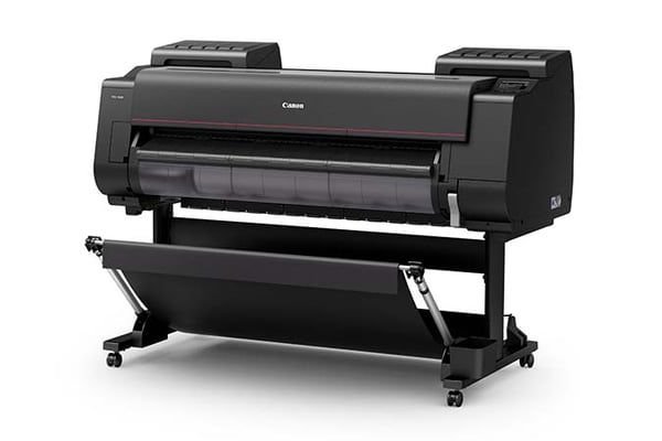
Many graphics printers or map plotters like the Canon PRO Series, include a large, on-board hard drive for print spooling.
On Board Available RAM
Random Access Memory is important, but sometimes it can be a bit of "smoke and mirrors" specification.
That is because some plotter manufacturers use virtual memory as a type of RAM. This is when the machine uses a portion of the hard disk to "swap" data as a way to manage memory.
The upside to this is a huge amount of room for data, but it takes a severe speed penalty.
Pigment Inks
Generally, GIS images tend to be displayed for a while. If you use a printer with regular dye based inks, then the image will begin to fade rather quickly.
Dyes are affected by both ultraviolet light and oxygen. On the other hand, pigments are fade and scratch resistant. They will give you much better quality and durability.
Shop now
Or request a custom quote
Color Space
Historically, CAD files have been simple black and white line drawings. Although color is starting to become more incorporated in CAD drawings and other technical files, the integration is relatively simple. It is usually in the form of color lines and not area fills.
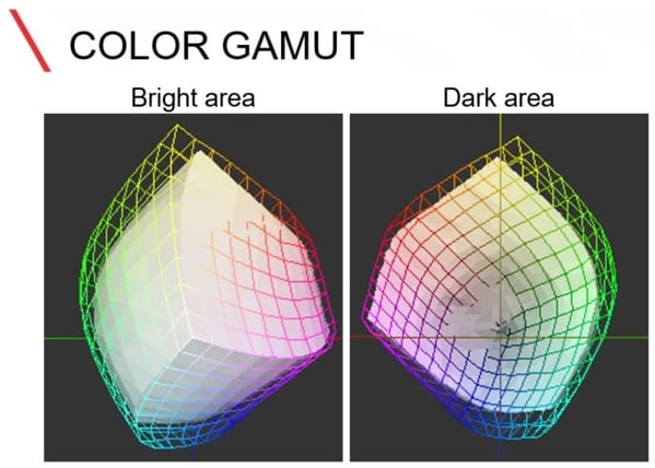
Maps however, have different requirements. They can range from having basic color areas to full-blown, photo-quality, satellite imagery.
At this point, a basic 4-color plotter can have some trouble producing a wide enough range of different colors to accurately render the image. This is because of the limited color space that basic CAD printers create.
(Canon defines color space as: A range of saturated colors that a device or file can embody. Various types of devices such as cameras, monitors, and printers all have different color spaces.)
Common CAD printers operate with a CMYK color space. They print using only four basic colors: Cyan, Magenta, Yellow, and Black. Whatever color combinations can be generated from these are the only colors that are capable of being produced by a CMYK printer.
To meet a greater color space demand, you should consider a printer that is loaded with more colors.
The wide-format printer industry calls them “Graphics Printers” but don’t let the name fool you. They are solid performers that work equally well in a GIS environment as they do in a print shop.
Graphic printers are usually configured with six, eight, or up to twelve different colors that allow the printer to yield literally millions of different colors. These additional colors allow you to make photo-quality images. This can be very useful with aerial photo with data overlays.
Durability of Prints
There are two components of an ink jet plotter’s final product—print material and ink. Most people have a good idea when it comes to the durability of print media.
It is obvious that a Mylar film will last longer and have much better archival properties than standard paper. However, ink is something that is commonly overlooked.
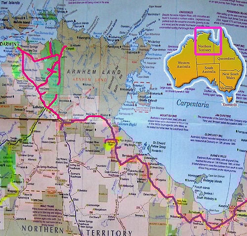 Photo credit: Neils Photography
Not all wide-format plotter ink is made the same. Even if you remove the name brand or manufacturer from the equation, ink can vary greatly.
Basic CAD plotters typically use a dye ink. This is simply an aqueous (water-based) solution that is colored Cyan, Magenta, Yellow, or Black. In layman's terms, Dyes are simply water colors.
Dyes yield good results, but they are not meant for long-term display. That is because dyes are very susceptible to fading and discoloration after exposure to sunlight and oxygen. This is the cause of faded prints.
Pigment Inks - hold up much better to the elements. Pigment inks are made of microscopic solid particles that are suspended in a liquid.
These encapsulated particles actually bond to the surface of a paper or substrate. Since the color of a pigment is determined by the solid bead and not the liquid carrier, they are much more durable and can be displayed for extended periods of time with no image degradation.
Usually, maps are produced to display, so pigment inks work great for that purpose. By combining both pigment inks and durable substrates, it is possible to produce maps that are capable of long-time displays.
Conclusion
The thing to remember when looking for GIS plotters is to get something that will perform best for your specific needs--not only now but in the future as well. Be sure to use some foresight when planning your technology deployment. Making a wise decision upfront may save you many headaches down the road.
What do you consider to be the most important attribute when considering types of plotter for printing maps?
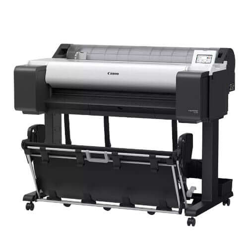
Unique technologies related to Canon PRO Series
Anti-clogging technology: The PF-10 print-head with FINE technology generates fast print speeds and reduces the possibility of clogging.
New LUCIA PRO Ink: an all new ink formulation with a new microencapsulation process that allows the inks to be even more densely laid down on the media, resulting in increased smoothness of the printed surface.
PRO S-Series Plotter Printer Models:
PRO-4100S: 44-inch printer
PRO-6100S: 60-inch printer
Learn more about Canon's innovative technologies in our Definitive Guide to Canon Plotters.
This article was originally published on our parent site:


No comments


0 comments